The beginning of June marks the start of the Atlantic hurricane season, the six-month period when strong storms can brew in the ocean and then wreak havoc on land. Among the hazardous consequences of hurricanes are storm surges, in which water rapidly rises above the normal tide level on shore. These dangerous events can cause flooding and pick up and displace homes and other structures. “Water is very powerful,” says Heather Nepaul, a meteorologist at the National Oceanic and Atmospheric Administration’s National Hurricane Center in Miami. “It can be a deadly situation.”
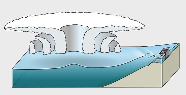
Surges occur when the strong winds of a hurricane interact with ocean waters, piling up water ahead of the storm. As the hurricane heads toward shore, it travels over shallower ocean, and the water it carries has nowhere to go but upward onto land.
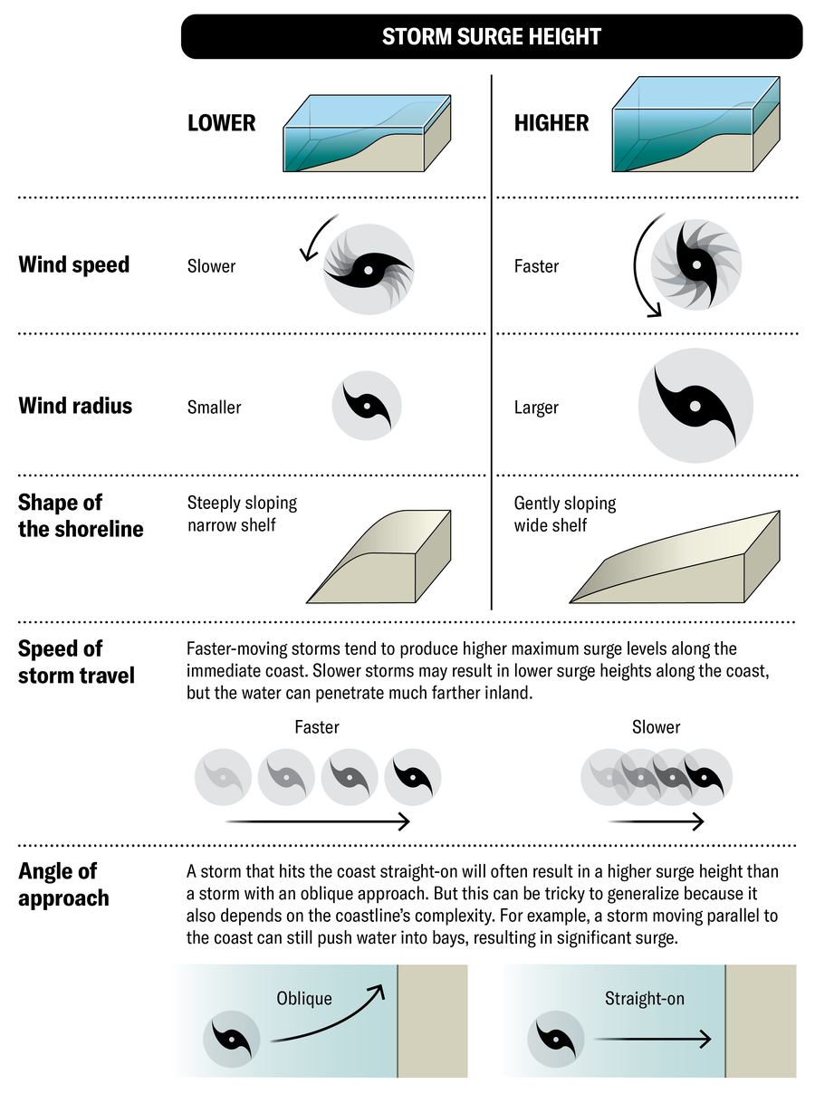
How severe a surge will be depends on many factors, including the characteristics of the coastline and the intensity, size and angle of approach of the storm. In general, though not always, stronger and larger storms produce higher storm surges.
On supporting science journalism
If you're enjoying this article, consider supporting our award-winning journalism by subscribing. By purchasing a subscription you are helping to ensure the future of impactful stories about the discoveries and ideas shaping our world today.
As the climate warms, hurricanes are becoming more intense, and sea levels are rising. Both of these effects are likely to worsen storm surges. Coastal areas that are already vulnerable to storm surge could experience worse impacts, and places that aren’t quite vulnerable now may become increasingly at risk.
HOW IT WORKS
The bulk of a storm surge is caused by wind pushing water ashore. A small part of the effect, however, results from the low atmospheric pressure inside a storm, which decreases the amount of downward force on the ocean, triggering a rise in water level.
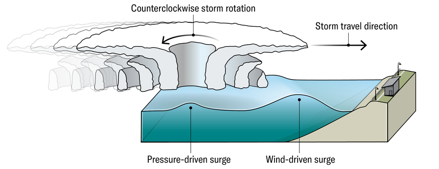
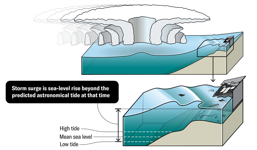
As the storm advances, its spiral of air pulls ocean water up into its center. When it nears land, the excess water surges over the shore above and beyond the normal tide level.
Jen Christiansen
VARIABLES THAT AFFECT STORM SURGE HEIGHT
The severity of storm surges is hard to predict because it depends on so many variables: the speed and radius of the wind associated with the storm, the hurricane’s size, the speed and angle at which the storm approaches land, and the specific shape of the shoreline where it hits.
Jen Christiansen
STORM SURGE RISK
These charts, based on the National Hurricane Center’s National Storm Surge Risk Maps, show the potential amount of surge along the U.S. Atlantic coast for hurricanes of different severity. Storms are categorized along a scale from 1 to 5 based on the strength of their winds, with 5 being the most intense. Surges can affect not just the coastline but locations many miles inland.
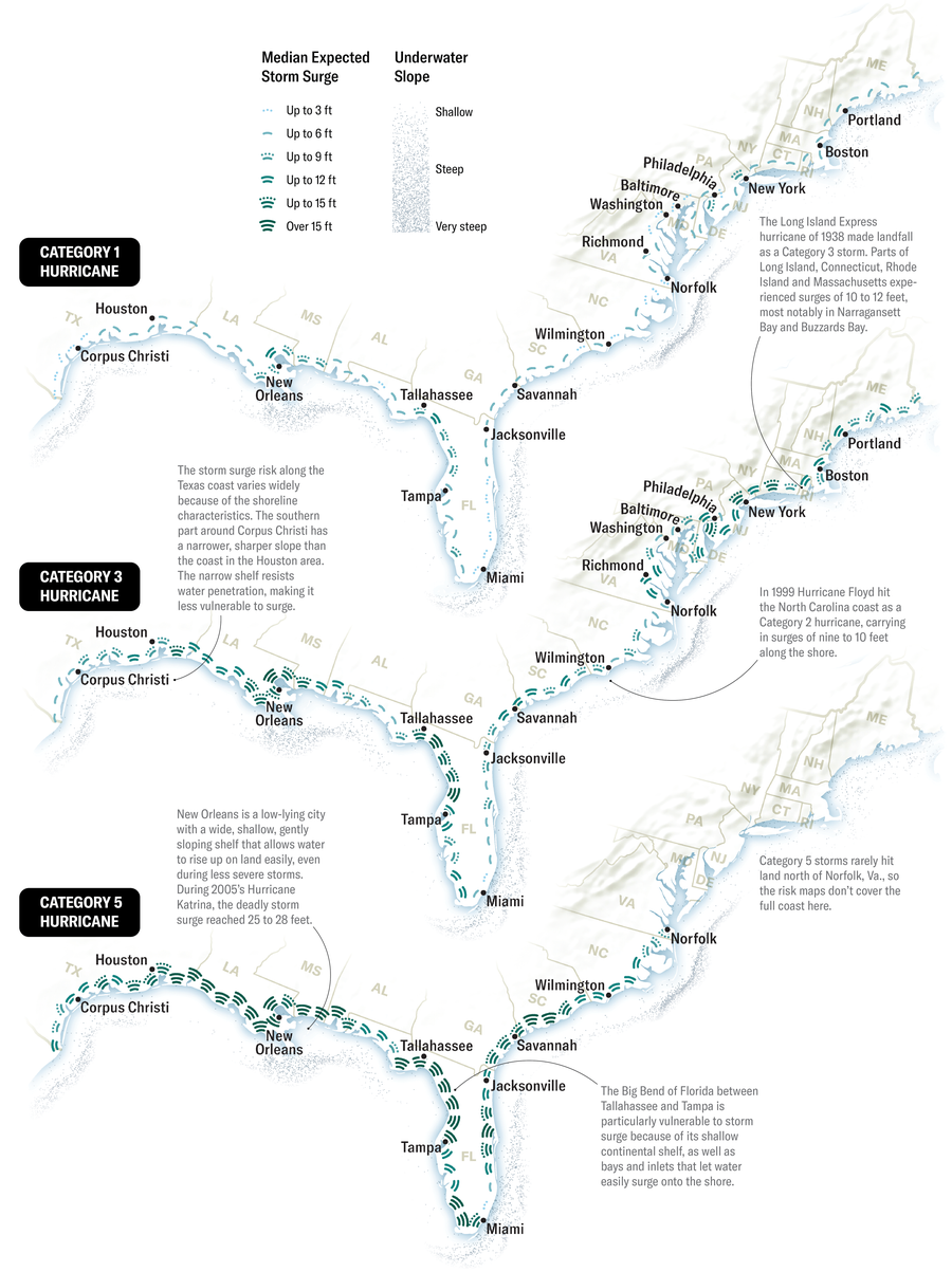
Daniel P. Huffman; Source: “A National View of Storm Surge Risk and Inundation,” by Brian C. Zachry, William J. Booth, Jamie R. Rhome and Tarah M. Sharon, in Weather, Climate, and Society, Vol. 7, No. 2; April 2015; via www.nhc.noaa.gov/nationalsurge (map data)